 Asset Publisher
Polish forests
 fot. Paweł Fabijański
 fot. Paweł Fabijański
 fot. Paweł Fabijański
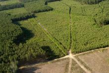
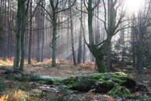
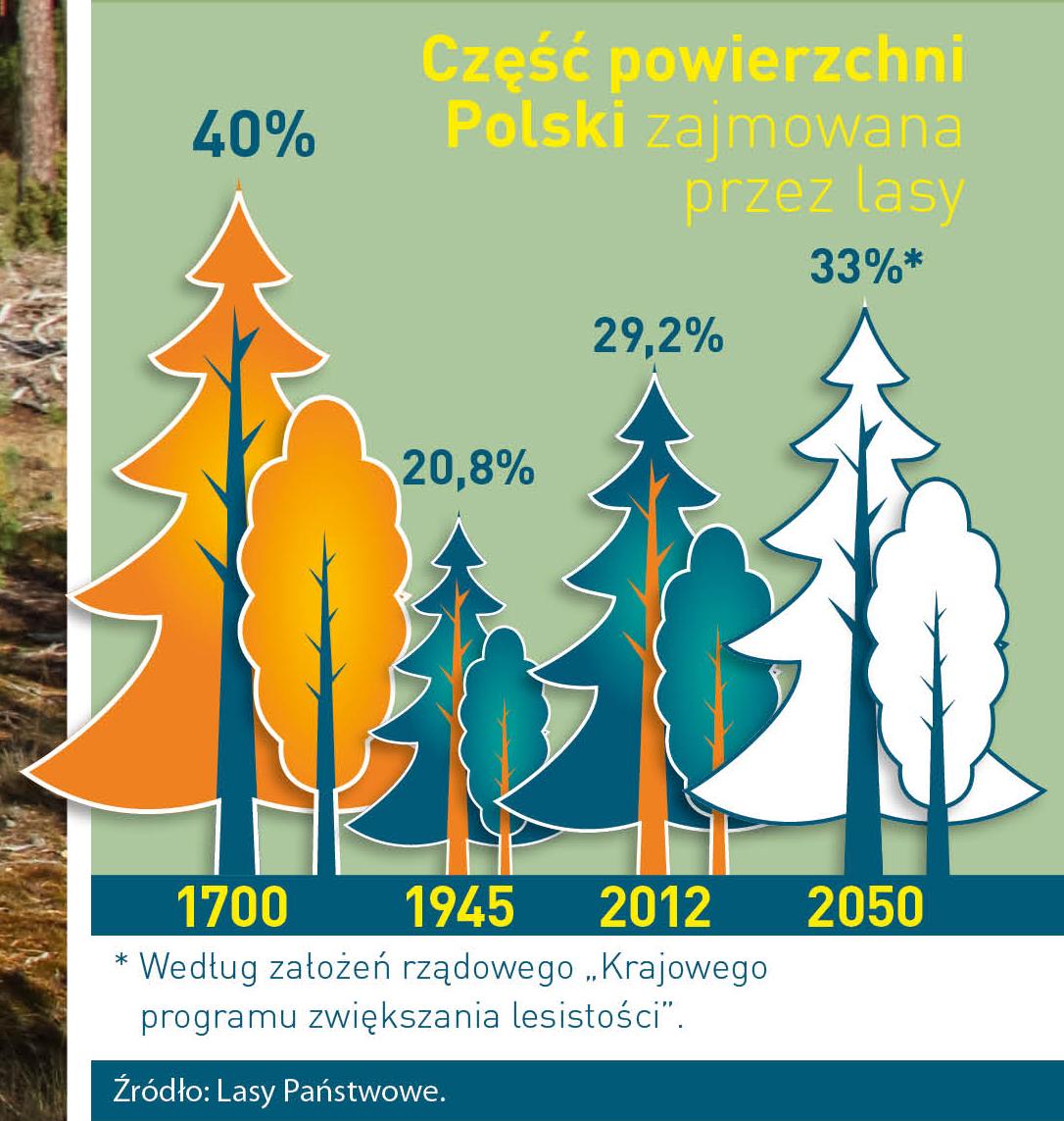
Poland is in the European lead, while concerning the area of all forests. They cover about 29,2 % of the country territory, and grow within the area of 9,1 million hectares. The overwhelming majority of the forests is state owned, of which almost 7,6 million hectares are managed by the State Forests National Forest Holding..
The number of Polish forest is still growing. The forestation rate of the country has increased from 21 % in 1945 to 29,2 % at the moment. Between 1995 and 2008, the forest area increased by 310 thousand ha. The basis for afforestation works is the "National Programme for Increasing the Forest Cover" (KPZL), assuming an increase of the forestation rate up to 30 % by 2020 and up to 33 % by 2050. Polish forests abound in flora, fauna and fungi. 65 % of the total number of animal species live there.
The forests grow in our country on poor soils, mainly because of the development of the agriculture in previous years. It influences the distribution of the types of the forest sites in Poland. Over 55 % of the forest areas is covered with coniferous forests. In other areas, there are forest sites, mainly the mixed ones. Their small part constitute alder and riparian forests – not more than 3 %.
In the years 1945 – 2011 the area of natural deciduous tree stands within the area of the State Forests National Forest Holding increased from 13 to 28,2 %.
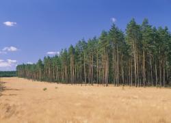
Within the lowlands and uplands the most often occurring tee species is pine. It covers 64,3 % of the forest area of the State Forests National Forest Holding and 57,7 % of private and commune forests. In the mountains the predominant species is European spruce ( in the west) and European spruce with beech (in the east). Domination of pine is the result of carrying on sustainable forest management in the past. Once, the monocultures (crops or cultivations of one species) were the answer to the great demand of industry for wood. Such forests appeared to be quite fragile to climatic factors. They also were often the prey of pests' expansion.
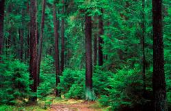
In Polish forests, the share of other tree species, especially deciduous trees have been systematically increasing. The foresters have stepped aside from monocultures – that is why, they try to fit specific species of the forest stand to the natural stand, that would be proper for the given area. Thanks to that, in the years 1945 – 2011, the area of the deciduous tree stands within the lands of the State Forests National Forest Holding increased from 13 to 28,2 %. There occur more and more frequently the following tree species: oaks, ashes, maples, sycamore maples, elms, but also birches, beeches, alders, poplars, hornbeams, aspens, tilias and willows.
Our forests are the most often represented by the forest stands aged 40 to 80 years. The average age of the forest equals 60 years. More and more trees are of big size at the age over 80 years. Since the end of the Second World War, the forests' area has increased up to almost 1,85 million hectares.
Raport o stanie lasów w Polsce 2012
Asset Publisher
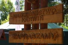
"Brązowe złoto" Puszczy Noteckiej
"Brązowe złoto" Puszczy Noteckiej
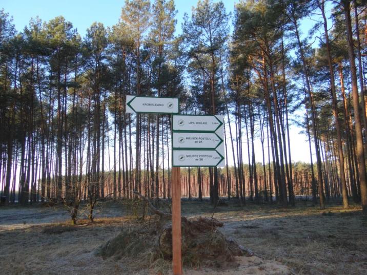
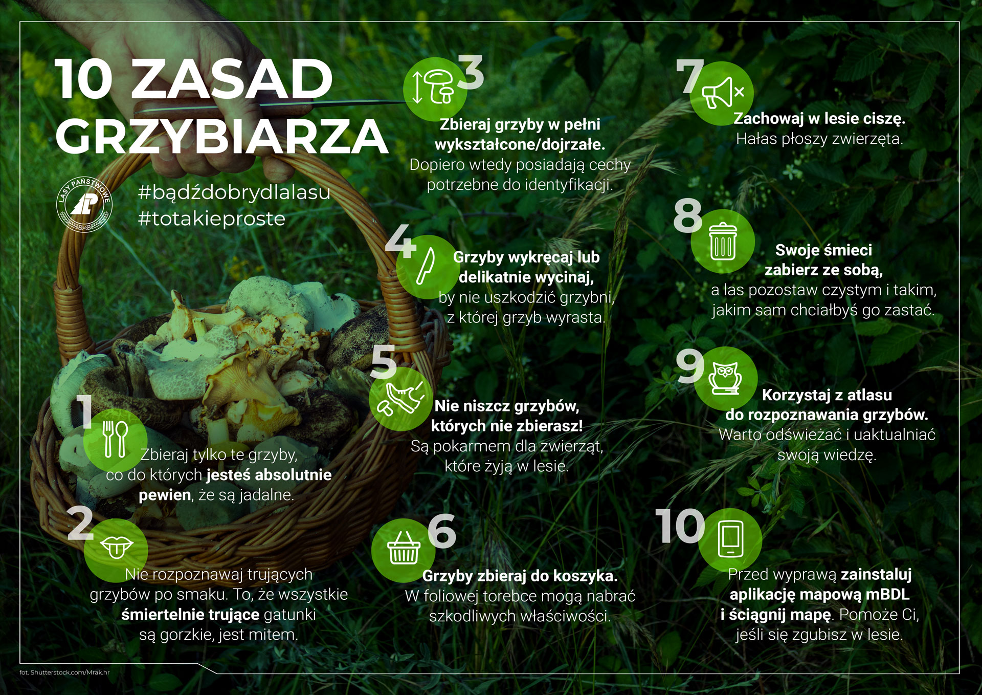
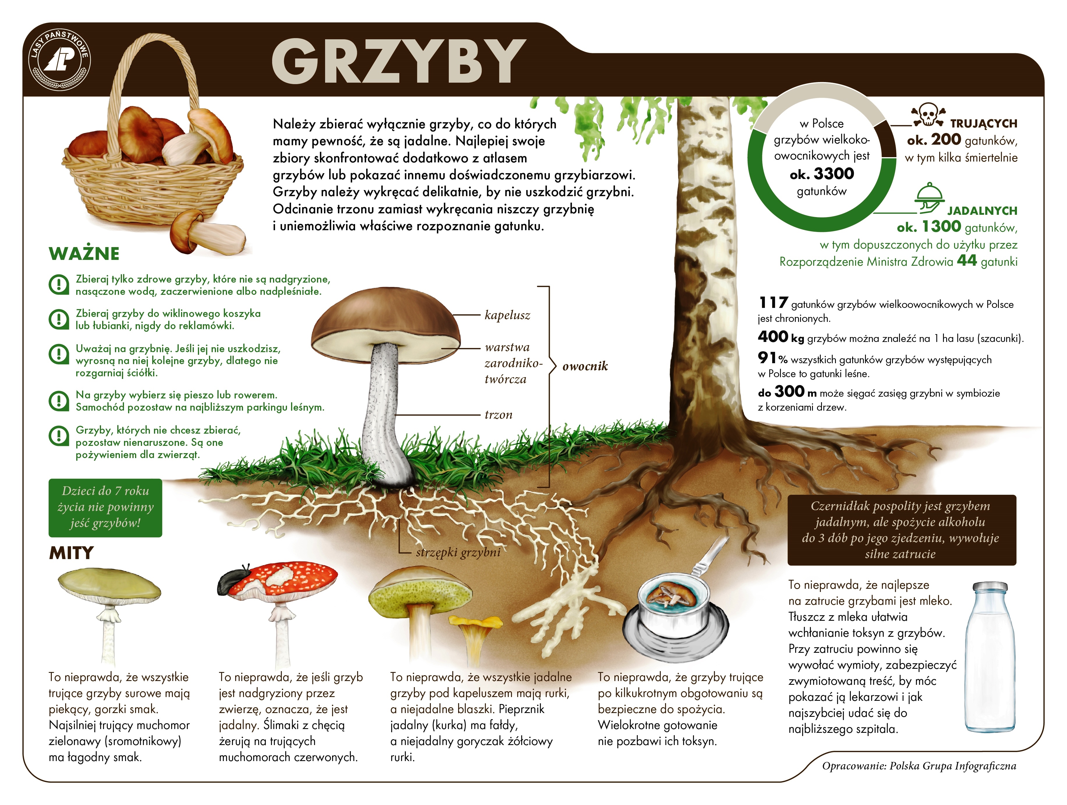
Nadleśnictwo Karwin położone jest w północno-zachodniej części Puszczy Noteckiej, ogromnego kompleksu leśnego, rozpościerającego się w rozwidleniu dużych rzek Warty i Noteci. Puszcza Notecka zwana jest „Krainą Tysiąca Grzybów”. Co roku przyciąga amatorów zbieractwa z niemal całego kraju. Wybierając się na grzyby warto zapoznać się z dekalogiem grzybiarza oraz podstawowymi informacjami o grzybach, które przedstawiają pomocne infografiki opracowane przez Lasy Państwowe:
Dla turystów odwiedzających Puszczę Notecką, został przygotowany szereg ułatwień:
• w Nadleśnictwie Karwin istnieją, liczne miejsca postoju pojazdów mechanicznych, na których należy pozostawić samochód czy motocykl (mapa miejsc postoju pojazdów znajduje się w załączniku na dole strony).
• oznaczone drogi, którymi można poruszać się pojazdami mechanicznymi. Warto wiedzieć, że w myśl Ustawy o lasach, poruszanie się pojazdami mechanicznymi w lesie dopuszczone jest wyłącznie drogami publicznymi lub wewnętrznymi, ale udostępnionymi do ruchu pojazdów. Po innych drogach nie należy się absolutnie poruszać! (mapa przedstawiająca drogi publiczne oraz udostępnione do ruchu znajduje się w załączeniu na dole strony).
• tabliczki kierunkowe obrazujące odległość w kilometrach do najbliższej miejscowości czy okolicznego miejsca postoju pojazdów.
• naklejki lokalizacyjne, dzięki którym w czasie zagubienia się w lesie podasz policji, służbie leśnej czy bliskiej osobie pomocne współrzędne geograficzne.
• istnieją bezpłatne aplikacje oraz portale, dzięki którym można ustalić własną lokalizację czy dowiedzieć się o interesujących obiektach w pobliżu:
1. Aplikacja mobilna „Puszcza Notecka” - https://play.google.com/store/apps/details?id=pl.amistad.treespot.puszcza_notecka&hl=pl&gl=US
2. Strona oraz aplikacja mobilna „Bank Danych o Lasach” – https://www.bdl.lasy.gov.pl/portal/
3. Portal turystyczny „Czas w las” - https://czaswlas.pl/mapa
Pamiętaj!
• wybierając się do lasu należy koniecznie sprawdzić prognozę pogody. W razie silnego wiatru, burzy czy intensywnych opadów atmosferycznych, lepiej przełożyć na kolejny dzień wyjście na grzyby. Nie lekceważ alertów Rządowego Centrum Bezpieczeństwa – mogą uratować twoje zdrowie i życie.
• apelujemy również o rozwagę. Nie igraj z ogniem, czasem iskierka wystarczy aby wzniecić pożar okrutny w skutkach. Niedogaszony papieros może być przyczyną zaprószenia się ognia. Należy korzystać odpowiedzialnie z walorów runa leśnego. Zagrożenie pożarowe możesz sprawdzić na stronie: http://bazapozarow.ibles.pl/zagrozenie/ jeśli w Twoim rejonie jest najwyższy poziom zagrożenia pożarowego, korzystniej będzie wybrać się na dalszą wycieczkę.
• nie zaśmiecaj środowiska! Las sam nie produkuje śmieci, pozostawione w nim odpady komunalne, stanowią zagrożenie dla roślin oraz zwierząt leśnych.